After a long wait by many Amateur radio operators, Es’hail 2, the first geostationary satellite carrying an Amateur radio transponder launched yesterday on a SpaceX Falcon 9 Full Thrust from the historical LC-39A pad in Kennedy Space Centre, which was used by many Apollo and Space Shuttle launches in the past.
Es’hail 2 is the second communications satellite operated by the Qatari company Es’hailSat. It was built by Mitsubishi Electric Corporation (MELCO). It carries several Ku and Ka band transponders intended for digital television, Internet access and other data services. It also carries an Amateur radio payload designed by AMSAT-DL, in collaboration with the Qatar Amateur Radio Society. The payload has two transponders, with S-band uplink and X-band downlink. One of the transponders is 250kHz wide and intended for narrowband modes, and the other one is 8MHz wide and intended for DVB-S and other wideband data modes.
SpaceX live-streamed the launch, and the recording can be seen in YouTube. Today, Space-Track has published the first TLEs for Es’hail 2 and the second stage of the Falcon 9 rocket. Here I look at these TLEs using GMAT.
The TLE for Es’hail 2 are as follows.
1 43700U 18090A   18319.95140571 -.00000497  00000-0  00000+0 0  9996
2 43700  25.0155 199.6281 7401796 178.1843  52.4356  2.15442580    0
The TLE for the Falcon 9 second stage rocket body are quite similar.
1 43701U 18090B   18319.94689066 -.00001224  10658-5  00000+0 0  99972
2 43701  24.9938 199.7032 7396449 178.0428  49.1658  2.16443176    02
The orbit in which Es’hail 2 has been delivered by the Falcon 9 rocket is a geostationary transfer orbit. The satellite will use its own propulsion over the next few months to manoeuvre itself into its geostationary orbital slot. The orbit described by the TLE is 37695 x 208 km high and has an inclination of 25º, which is roughly the lowest inclination that can be achieved launching from KSC, which is at 28º latitude. As usual in a geostationary transfer orbit, the perigee and apogee are over the equator. Indeed, the argument of perigee is 178º (an argument of perigee of 0º or 180º or would indicate that the perigee is exactly over the equator). Another particularity of geostationary transfer orbits is that their apogee is close to the geosynchronous height (35786km). The epoch for this TLE is 2018-11-15 22:50:01 UTC.
As a quick summary of the launch, extracted from the video, lift-off was at 20:46 UTC. First stage separation happened at 20:49, at an altitude of 69km. The second stage cut-off was at 20:54, at 164km of altitude. The second stage then coasted until 21:13, at an altitude of 183km, when the second stage fired again for about one minute. The payload separation was at 21:18.
I have made a Jupyter notebook to convert the TLEs into Keplerian elements for GMAT. The conversion is not very accurate, since the SGP4 model is not taken into account, but is adequate for these purposes.
In the GMAT script launch.script I have used the TLEs for Es’hail 2 and back-propagated them until the perigee, which should match with the point of the second second-stage burn. This happens to be at 21:12:40 and an altitude of 198km, which matches the launch video quite well.
After this, I’ve propagated forward for 330 seconds, to the point where separation occurred. According to GMAT, this happened at an altitude of 556km, which matches more or less the video (although the altitude is increasing quickly and not seen in the exact moment of separation).

Then I have propagated until the first apogee, which happened at 2018-11-16 02:46:51 and an altitude of 37687km. Next I have propagated until perigee to complete the first orbit. This happened at 2018-11-16 08:21:01, again at an altitude of 198km. The orbital period is approximately 11 hours and 10 minutes. All this assumes that the propulsion of the satellite hasn’t been activated yet. We will see in future TLEs whether this has been the case.

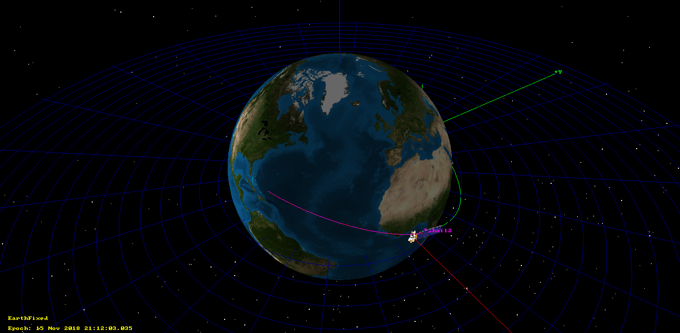
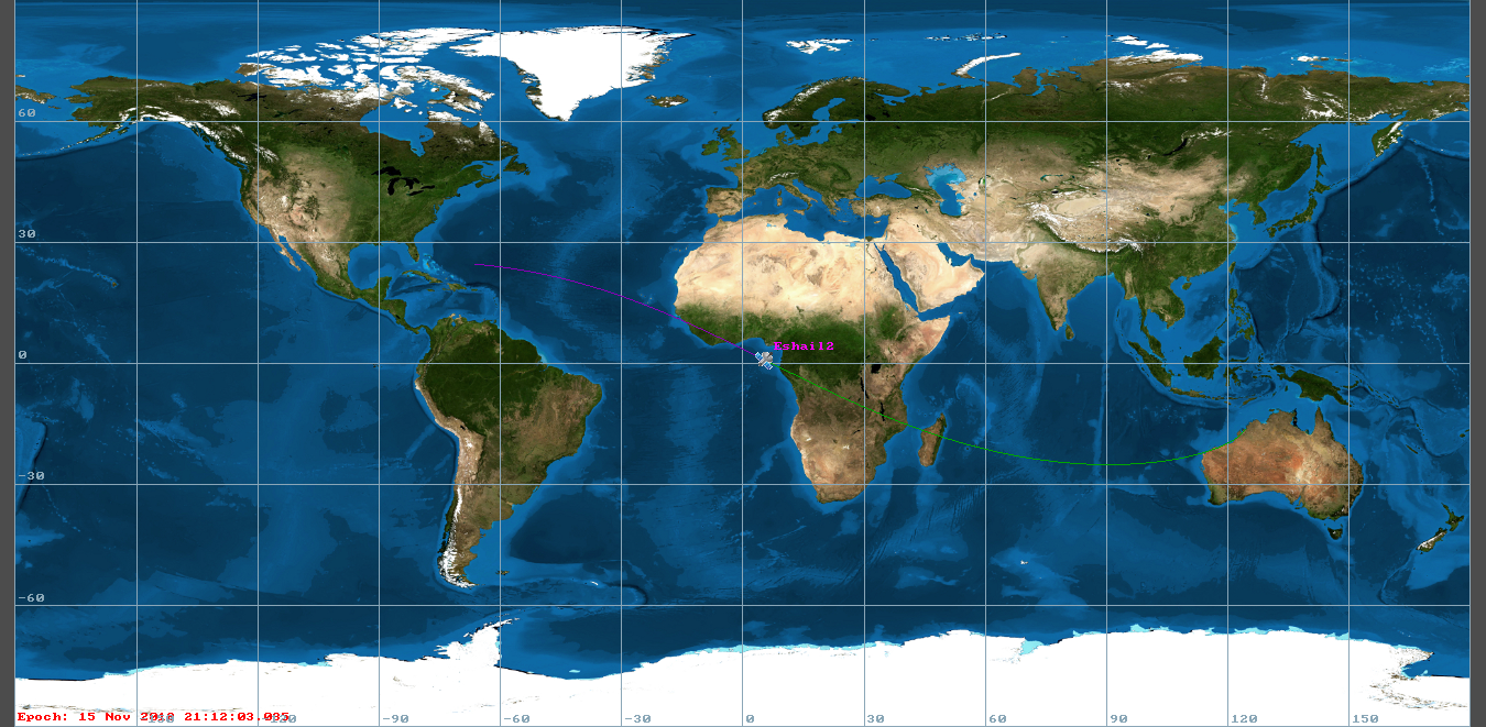
The groundtrack of Es’hail 2 over its first orbit can be seen in the figure below.

I have used a second GMAT script ses2.script to calculate the second burn of the second stage. In the video, the speed changes from 26595km/h to 35457km/h, giving a delta-v of 2.462km/s. However, if we use this delta-v in GMAT when back-propagating, we get an orbit before this second burn that doesn’t match the video (the altitude is too high).
Therefore, I have used the altitude at the end of the first second-stage cut-off as a target to compute the delta-v using a differential corrector. I get a delta-v of 2.511km/s. The coast orbit between the first and second burns of the second-stage turns out to have a perigee altitude of 109km. By construction, the apogee of this coast orbit is the point of the second second-stage burn. The coast orbit is shown in the two figures below.
So far, this is all I have done with the first TLE for Es’hail 2. My plan is to monitor future TLEs to track the manoeuvres made by the satellite to position itself in its GEO slot. It would also be interesting to try to track the satellite by using any of its RF beacons, but I don’t know their frequencies. Any information regarding this is welcome.
One comment