This post is going to be slightly unusual for the topics of this blog, because there is no RF, but nevertheless there is space-based remote sensing, which fits somewhat well with the things I usually write about. I wanted to write down this information somewhere, and it was too long for a series of tweets.
As some of you might have heard in the news, there has been a large wildfire in Tres Cantos, Madrid, Spain, which is the city where I live. This has even been featured in international news. First of all, I am okay, as are all the family and friends I have in the city. The fire broke out on 2025-08-11 17:45 UTC (19:45 local time) and by the next morning its perimeter was already contained. As of writing this post on the morning of 2025-08-13, the fire is almost put out and is considered to be controlled. We have been lucky that a fire so close to the city has caused relatively low damage. I am not keeping a tally, but what I heard is: one person’s life, a few houses in the borders of the city, as well as a few countryside houses and sheds, the King’s College British school, and the 17th century Viñuelas castle, as well as part of the castle grounds, which consist of 3000 hectares of holm oak woodland, commonly known as “Monte de Viñuelas”.
Since I woke up on the morning of 2025-08-12, I have been very interested in understanding which area has been affected by the fire. The information I could see in Google maps, and even in some news articles (which could have been based off Google maps) didn’t quite match what I had seen in pictures and videos shared in social media, as well as what I saw by driving on the streets bordering the town. An official map has not been published, as far as I know. So I have been keeping an eye on space-based imagery platforms to see when the first images taken on 2025-08-12 would pop up. I don’t use these services frequently, so this has also helped me get up to speed on the current constellations, platforms and services. This is the topic of this post.
I will start by showing how Google maps has been showing the wildfire area over 2025-08-12 and the morning of 2025-08-13. The red zone means “active” and yellowish are means “possibly active”. Looking at this, it looks like the fire might have burnt through the southeast of the city, which is where I live. If I were to believe this map, the end of my street would be possibly on fire, which is definitely not the case.
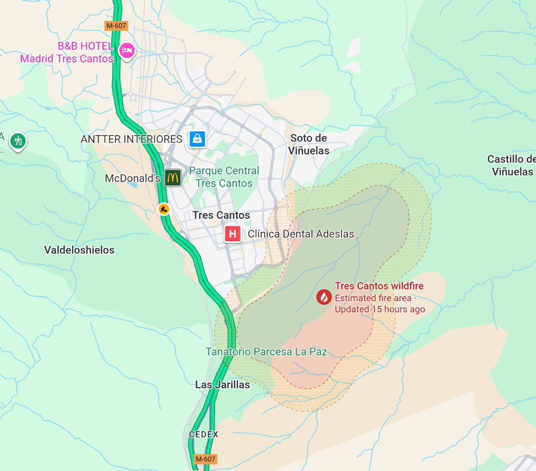
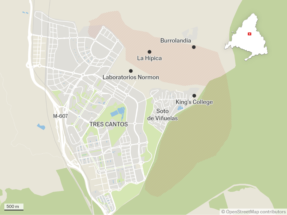
More importantly, all the reports I have seen from the fire have been from the northeast part of the city rather than the southeast. The newspaper El País published yesterday the following map, which as we will see, is reasonably accurate. It shows an area on the northeast of the city and the names of some affected places. This area matches all the reports that I had seen. There is also an area east of the city that somewhat resembles that shown on Google maps, but not quite.
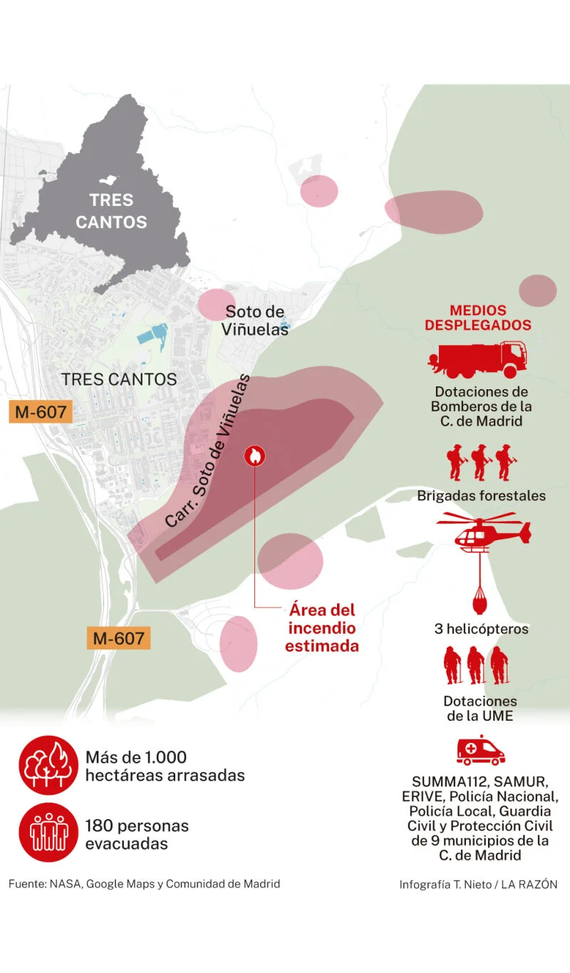
Other newspapers have been showing worse maps that might have been partially inspired by what Google maps is showing. For instance, La Razón showed this somewhat non-sensical map that has multiple disconnected areas.
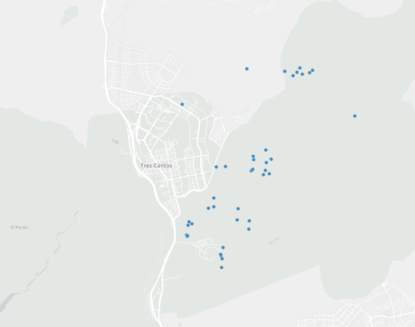
So what is going on here? I think that these maps are partially based on VIIRS satellite data. The following map shows the potential fire hot spots detected by VIIRS. It looks like Google maps is grabbing the cluster of VIIRS detections on the southeast of the city and making an area with them. The remaining detections probably do not have enough density (or enough power) and are ignored by Google maps.
La Razón seems to have done pretty much the same, showing an area for each cluster of VIIRS detections, thus leading to non-sensical disconnected regions. El País has been much smarter, and while perhaps it might have used VIIRS as a guideline, it has also has included an accurate account of areas on the northeast of the city that even if not showed by VIIRS, are known to have burnt because people would photograph them from their windows on the night of the fire and because reporters could see them from the streets bordering the town on the next morning.
I know next to nothing about fires, but I heard that this fire burnt particularly quickly due to strong winds. The area to the northeast of the city is mostly pastures. There are few trees, so this time of the year it is mostly dry grass and small plants, and it might have been cut down in some areas to prevent fires. So maybe there is just not enough fuel to cause high temperatures. Perhaps this explains why this area doesn’t show up in VIIRS.
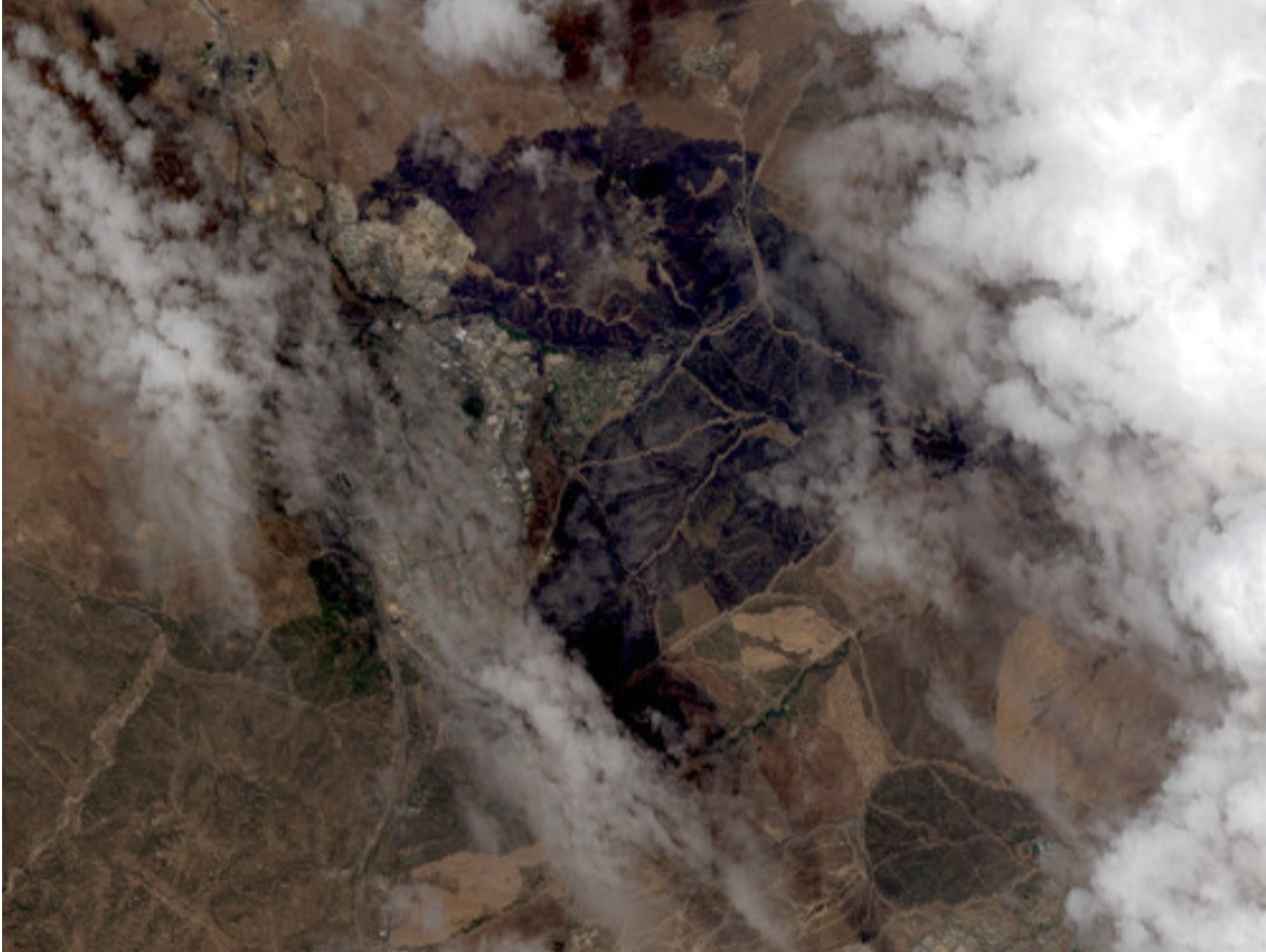
Since 2025-08-12 was mostly cloudy, I didn’t expect great satellite images, so I was quite surprised to discover this morning in UP42 an image from Pléiades Neo that shows a reasonably good view of the burnt area through a lucky break in the clouds. The image I’m showing here is just the low-resolution preview for the data product. The data product has 30 cm/px resolution, but it costs slightly over 1000€, so I’m not going to buy it for personal use (but I understand that 1000€ paid by disaster responders for this valuable data might actually be a bargain).
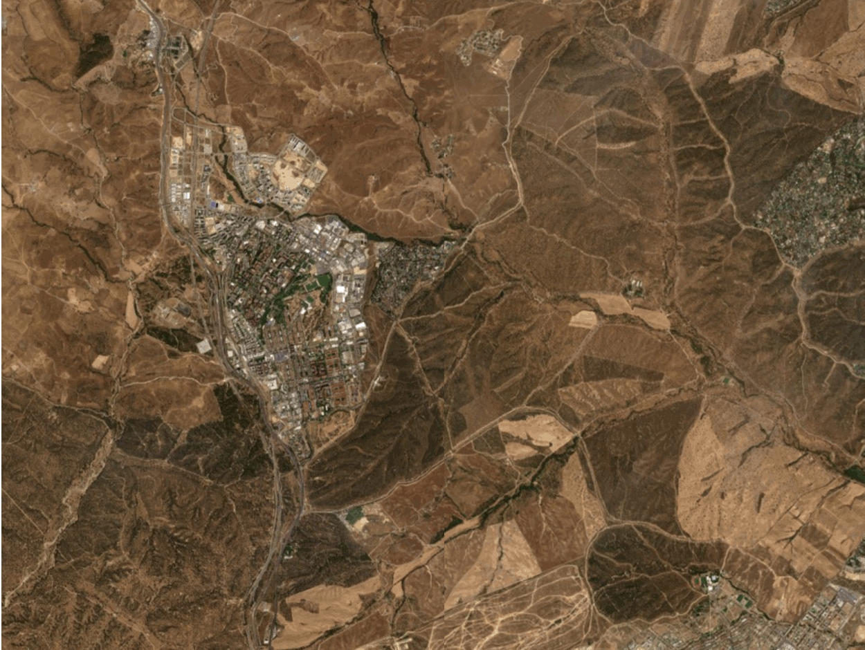
For comparison, this is a Pléiades Neo image from the same area from few days ago on a clear day.

Here is an animated GIF that toggles between the two images for easier comparison.
Something that is important to understand is that Monte de Viñuelas (the castle grounds) is bordered by a wall made of granite boulders and concrete that is around 1 to 2 metres high depending on the area and about 50 cm thick. I have drawn this wall by hand over the Pléiades Neo images.
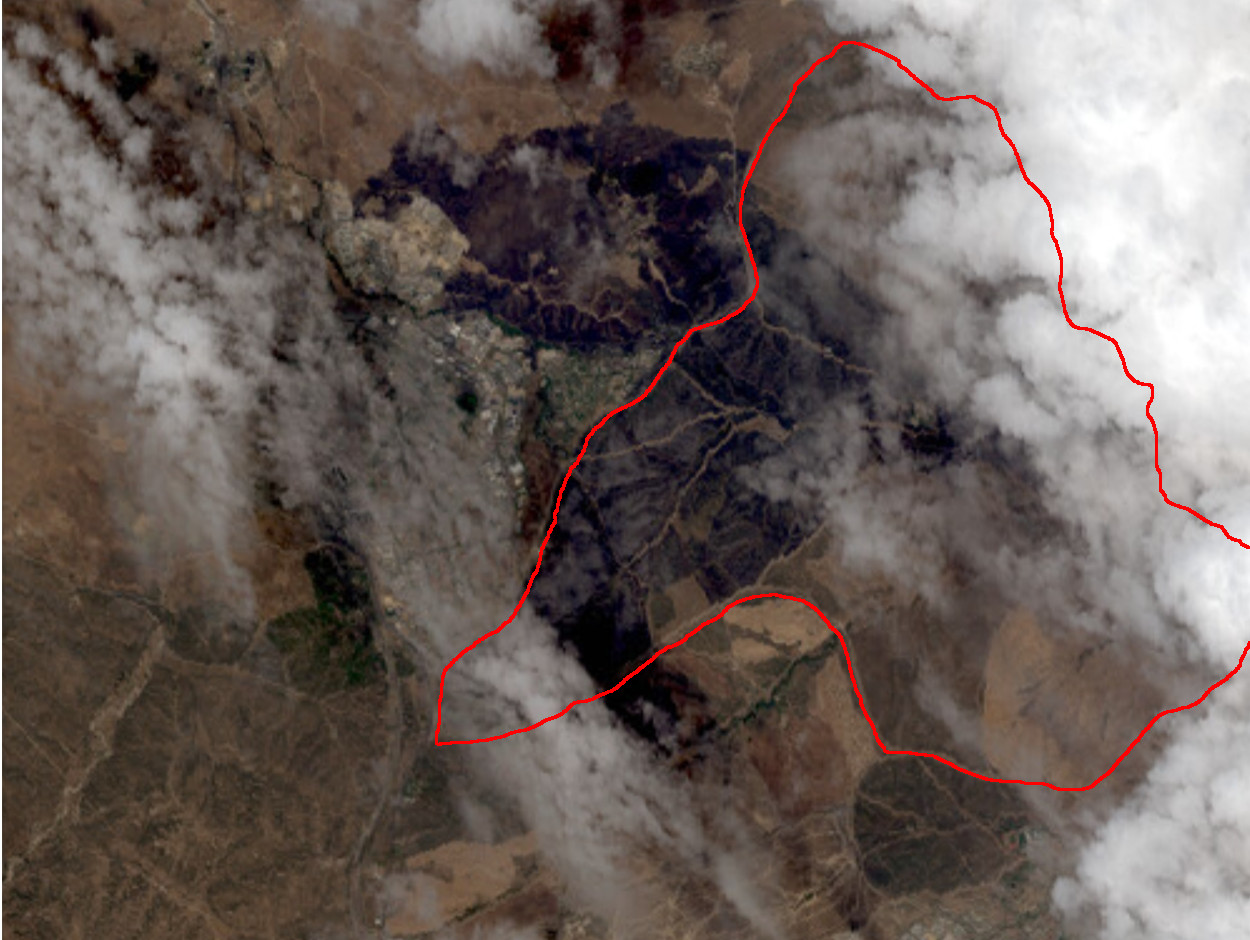
Tres Cantos wildfire image from Pléiades Neo on 2025-08-12, including hand-drawn wall of Monte de Viñuelas
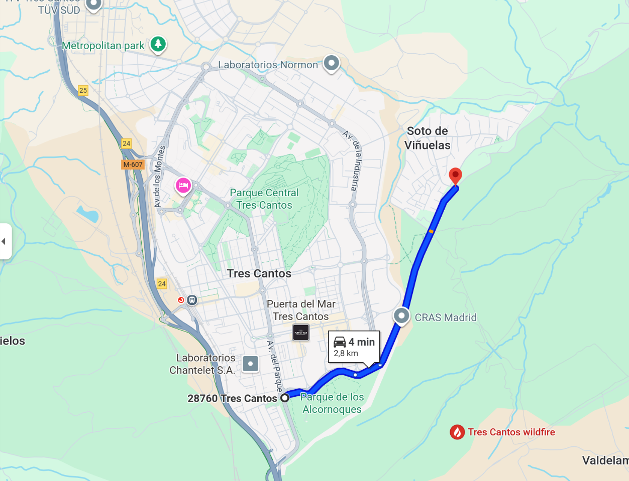
As you can imagine, it is not easy for fire to jump over this wall. I think that what happened is that the fire started somewhere northeast of the city, outside of the wall. This is what is indicated by all the reports I have seen. At some point the fire managed to jump over the wall into Monte de Viñuelas. Then it burnt through the oak woodland in Monte de Viñuelas, spreading southwards and eastwards. But what is crucial: it did not jump back west through the wall again. So the fire hasn’t affected the fields that are outside of the wall and to the east and southeast of the city. I could verify it with my own eyes this morning by driving on the road shown below. However it looks like the fire was able to jump out of Monte de Viñuelas at some point on the southern wall.
On this short drive I could also see that the situation in this part of Monte de Viñuelas might not be as bad as the Pléiades Neo image could suggest. The treetops of the oaks looked mostly unaffected, but the grasses and plants on the ground had burnt. I couldn’t say for certain what the impact is, since it is not possible to see deeper into the woods from the road (remember that there is a wall).
Comparing the Pléiades Neo image with the map from El País, we see that El País got it mostly right. It just failed to account the extent of the fire into Monte de Viñuelas and also that it spread further north. But knowing that would have been hard without detailed information from first responders .
Besides UP42, other platforms in which I have tried to get satellite imagery are EOS LandViewer, SkyWatch Explore, Planet Insights Platform, and Copernicus Browser. Let me know if I have missed other good platforms, since I don’t really know which are the best sites. I will keep an eye to see if I can get a cloudless image in a few days (today is still partially cloudy), and whether there is imagery that can be downloaded for free, such as Sentinel-2 data, so I might publish a follow up to this post.
There are two reasons why I have written this post. The first is to improve my understanding of the world around me. This is a common thread on this blog (I can imagine that this post will get readers that are unfamiliar with the usual topics of my blog). The second is to raise public awareness about the importance and usefulness of satellite-based imaging and remote sensing in general.
Update 2025-08-13 20:00 UTC: I have seen that now there is also Sentinel-2 imagery for today available. The sky has been clear for most of the day, and this image has no clouds. It can be seen in Copernicus Browser.
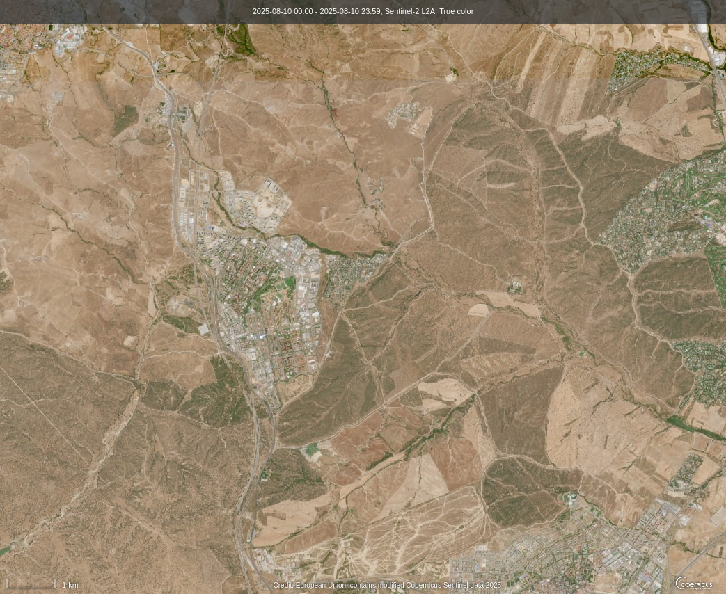
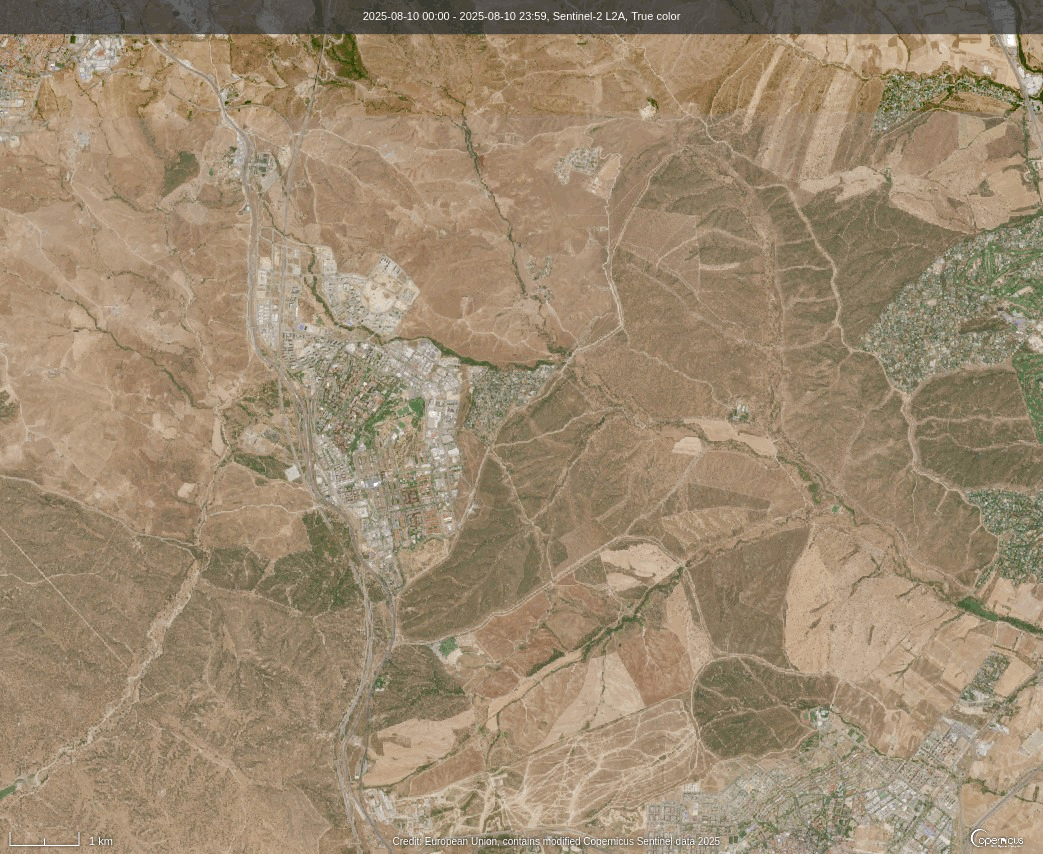
Sentinel-2 has a resolution of 10 to 60 m/px, which is not as amazing as the 30 cm/px that sate of the art high resolution missions such as Pléiades Neo have. On the other hand, the data products are free. Sentinel-2 is a multispectral mission that has 13 bands covering the visible, near infrared and short-wave infrared spectrum. Here is an L2A (atmosphere-corrected) true colour image (based on the bands B2, B3, B4, which are blue, green and red) of 2025-05-10, the day before the fire started. The image has been exported directly in Copernicus Browser.
The image for today with the same settings is shown here.
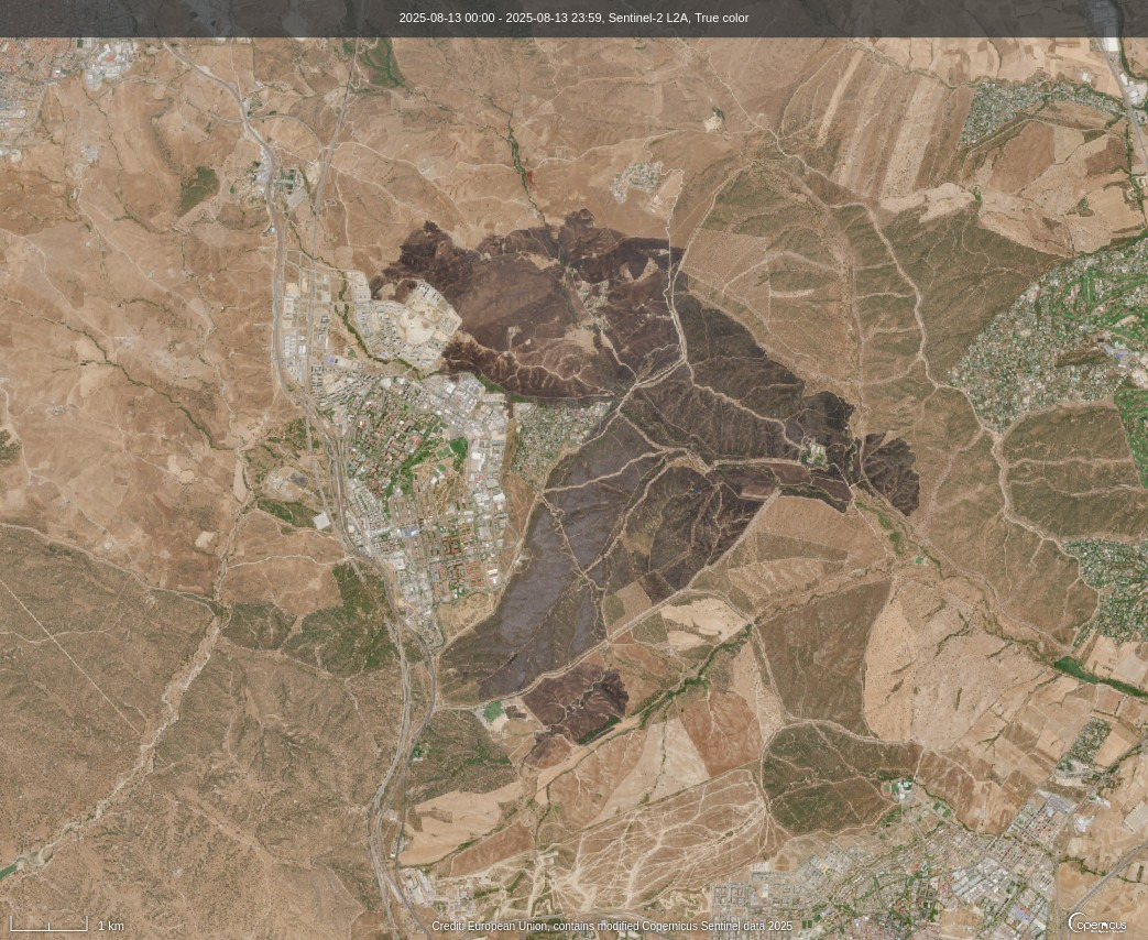
The two images are compared in the following animated GIF.
I might write a new post showing how to do some processing of the data products. I know next to nothing about multispectral image processing, but I’m interested in finding out whether I can use the infrared bands to determine if the trees have been burnt. I will probably learn something.
Thank you for this, I taught for a year at CEIP Antonio Osuna and based on the map on google I was quite worried about it. (I live outside Spain now). Glad the town is mostly ok and wishing you the best from the US
Thanks for your support. CEIP Antonio Osuna is completely fine. I drove past its fence this morning.